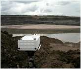
| Oil sand site |
Using spectra to evaluate resources |
Identifying promising resource locations |
 |
 |
 |
| An example of an oil-rich field site |
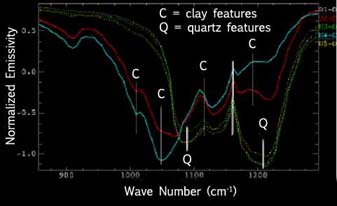
Spectra identifying clay (poor oil source), quartz (rich oil source) |
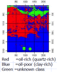
Mapping predictions of spectrally determined rich and poor sources reduces wildcat-type oil exploration |
- Remote sensing techniques can be used to enhance oil extraction efficiency and productivity, and, in turn, reduce costs and environmental impacts during all phases of oil sands mineral extraction. From the prospecting phase through operations and reclamation, Core-Net identifies and develops remote sensing techniques that help oil companies get more oil per extraction dollar and per cubic meter of ore. By developing techniques to identify resource-rich locations, monitoring bitumen content in order to improve processing efficiency, and offering a quantitative way to evaluate and demonstrate compliance with legally mandated reclamation requirements, oil companies can more efficiently allocate their resources. Core-Net takes a leadership role in expanding Canada’s unsurpassed ability to use innovative oil production methods to provide the world with a secure and reliable supply of vital energy resources.
Go to Mining Research | Mineral Mapping Research
|